BCE Telematics solution
Geofences
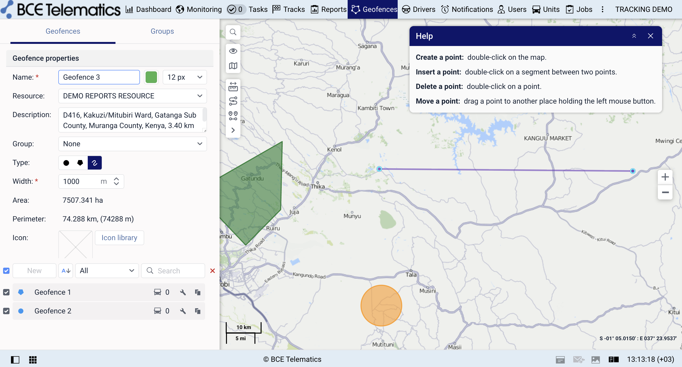
Geofences turn map areas into business rules. We configure zones, groups and notifications around the way your fleet actually works.
Details
How this helps your fleet
Build virtual zones for depots, customer sites, restricted areas, countries, routes and operational locations.
Every BCE Telematics setup can be adapted to the customer’s fleet, users, reports and operational workflow. We help with configuration, training and support so the system is useful for end users, not only installed.
Main capabilities
- Depot, customer and route zones
- Entry, exit and duration tracking
- Restricted area alerts
- Zone-based reports
- Customer site visibility
How we configure it
From raw telematics data to a working fleet process
Each software solution is prepared around the real questions your team needs answered: where the vehicle is, what happened, who is responsible and which action should follow.
Draw or import zones
Assign rules and units
Report visits and trigger alerts
Operational results
- Better site activity control
- Clear arrival and departure records
- Automatic exception visibility
Daily use
Location rules connected to real sites
Depots, customer locations and restricted zones become usable operational checkpoints for arrivals, departures, duration and exceptions.
Implementation
Delivered with practical telematics knowledge
We do not only provide software or devices. We help end users understand how to use the system, how to read reports and how to improve the setup over time.